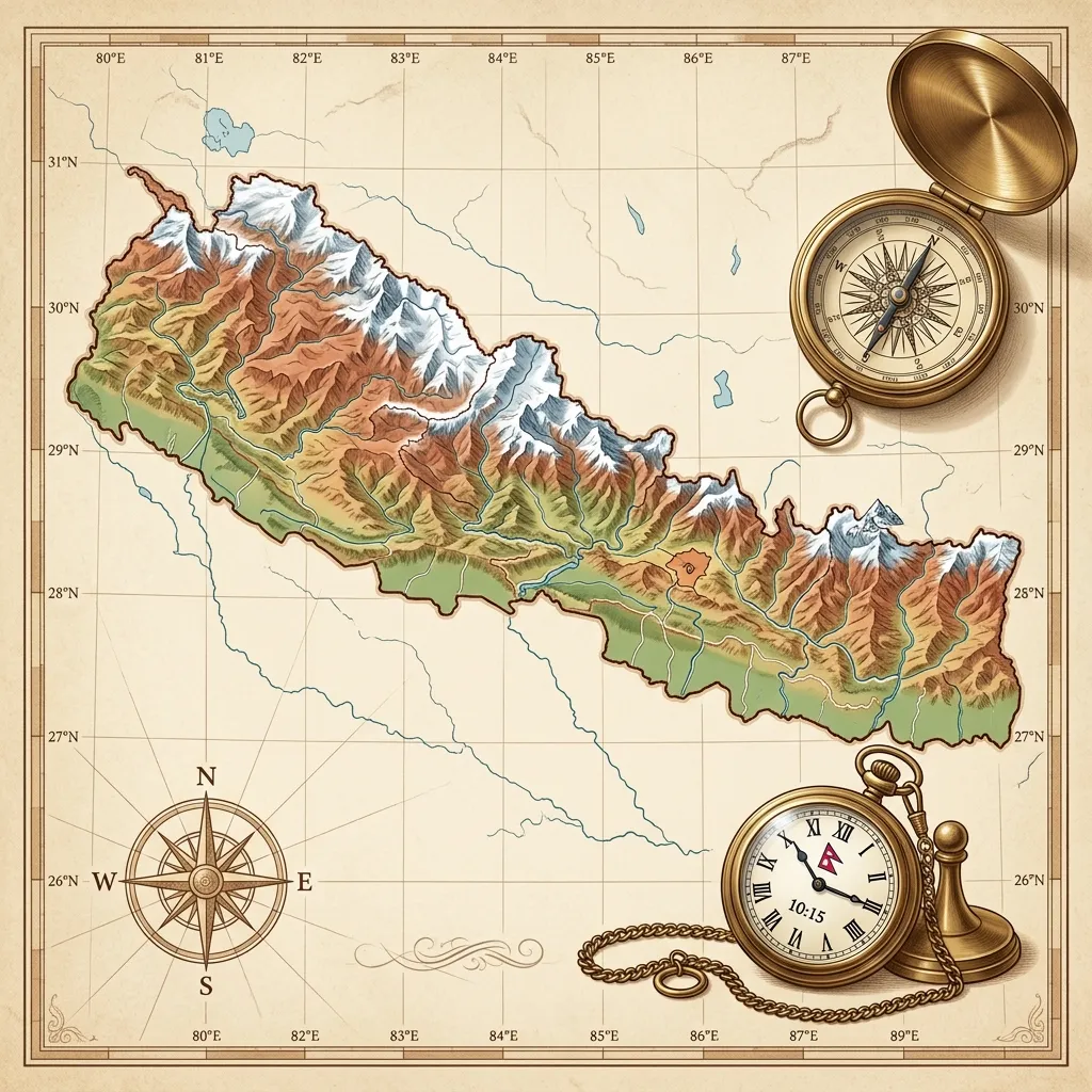
Latitude and longitude play a crucial role in determining the exact geographical location of any place and its local time. The following data clarifies the latitude, longitude, and time difference from Nepal Standard Time (NST) for the headquarters of Nepal's 14 zones and 75 districts.
This information is considered extremely important for astrology,
Panchang (almanac) construction, and geographical studies.
1. Relationship Between Nepal’s Standard Time and Longitude
Nepal's Standard Time is determined based on the 86° 15' (86 degrees 15 minutes) East Longitude, which passes through Gaurishankar Himal in the Dolakha district. This time is 5 hours and 45 minutes ahead of Greenwich Mean Time (GMT).
The time difference for various districts in Nepal is calculated based on this standard time.
2. Time Difference Between East and West
Since the Earth rotates from west to east, sunrise occurs earlier in the eastern parts, and the local time is ahead.
- Positive (+) Time Difference: Districts located east of Gaurishankar Himal (86° 15') have a local time ahead of the standard time. Therefore, districts in the Mechi, Koshi, and Sagarmatha zones have a (+) sign in the table. For example, Jhapa (Chandragadhi) in the far east has a time difference of +7:16 (7 minutes 16 seconds ahead).
- Negative (-) Time Difference: Districts located west of Gaurishankar Himal have a later local time. Districts from Janakpur to the Mahakali zone have a (-) sign. For example, Kanchanpur in the far west has a time difference of -24:16 (24 minutes 16 seconds behind).
This data shows that there is a local time difference of approximately 31 to 32 minutes between Nepal's easternmost and westernmost points.
3. Mathematical Method for Local Time Calculation
- Time Outside Headquarters: The latitude and longitude provided in the table are for the district headquarters only. To find the time for a village or place east or west of the headquarters, a calculation must be made based on distance.
- 24 Kilometers = 1 Minute: On average, a distance of 24 kilometers results in a 1-minute time difference. If your location is east of the headquarters, add time; if west, subtract time.
- Ishtakal Construction: In a Panchang, the sunrise time for Kathmandu's standard time is often used. Therefore, when calculating the Ishtakal (auspicious birth time) for a child born in other districts, only the longitude correction (deshantar sanskar) is necessary.
Geographical and Time Difference Data of Nepal's Districts
Mechi Zone
| District | Latitude (N) | Longitude (E) | Time Diff (M.S) |
|---|
| Jhapa (Chandragadhi) | 26°35' | 88°4' | +7:16 |
| Taplejung | 27°21' | 87°41' | +5:44 |
| Panchthar (Phidim) | 27°8' | 87°46' | +6:04 |
| Ilam | 26°55' | 87°55' | +6:40 |
Koshi Zone
| District | Latitude (N) | Longitude (E) | Time Diff (M.S) |
|---|
| Morang (Biratnagar) | 26°27' | 87°17' | +4:08 |
| Sunsari (Inaruwa) | 26°36' | 87°09' | +3:36 |
| Dhankuta | 26°58' | 87°20' | +4:20 |
| Tehrathum | 27°8' | 87°32' | +5:08 |
| Sankhuwasabha | 27°22' | 87°13' | +3:52 |
| Bhojpur | 27°10' | 87°04' | +3:16 |
Sagarmatha Zone
| District | Latitude (N) | Longitude (E) | Time Diff (M.S) |
|---|
| Solukhumbu (Salleri) | 27°30' | 86°36' | +1:24 |
| Khotang (Diktel) | 27°13' | 86°48' | +2:12 |
| Okhaldhunga | 27°19' | 86°32' | +1:08 |
| Udayapur (Gaighat) | 26°47' | 86°32' | +1:08 |
| Saptari | 26°32' | 86°45' | +2:00 |
| Siraha | 26°39' | 86°13' | -0:08 |
Janakpur Zone
| District | Latitude (N) | Longitude (E) | Time Diff (M.S) |
|---|
| Dhanusha (Janakpurdham) | 26°43' | 85°56' | -1:16 |
| Mahottari (Jaleshwar) | 26°39' | 85°48' | -1:48 |
| Sarlahi (Malangwa) | 26°51' | 85°33' | -2:48 |
| Sindhuli (Madhi) | 26°43' | 85°55' | -1:20 |
| Ramechhap (Manthali) | 27°27' | 86°06' | -0:36 |
| Dolakha (Charikot) | 27°41' | 86°03' | -0:48 |
Bagmati Zone
| District | Latitude (N) | Longitude (E) | Time Diff (M.S) |
|---|
| Sindhupalchok (Chautara) | 27°47' | 85°43' | -2:08 |
| Kavrepalanchok | 27°37' | 85°34' | -2:44 |
| Lalitpur (Patan) | 27°41' | 85°20' | -3:40 |
| Bhaktapur | 27°40' | 85°26' | -3:16 |
| Kathmandu | 27°42' | 85°19' | -3:44 |
| Nuwakot (Bidur) | 27°53' | 85°08' | -4:28 |
| Rasuwa (Dhunche) | 28°07' | 85°18' | -3:48 |
| Dhading | 27°54' | 84°54' | -5:24 |
Narayani Zone
| District | Latitude (N) | Longitude (E) | Time Diff (M.S) |
|---|
| Makwanpur (Hetauda) | 27°26' | 85°02' | -4:52 |
| Rautahat (Gaur) | 26°46' | 85°16' | -3:56 |
| Bara (Kalaiya) | 27°02' | 85°02' | -4:52 |
| Parsa (Birgunj) | 26°59' | 84°52' | -5:32 |
| Chitwan (Bharatpur) | 27°40' | 84°26' | -7:16 |
Gandaki Zone
| District | Latitude (N) | Longitude (E) | Time Diff (M.S) |
|---|
| Gorkha (Gorkhakali) | 28°00' | 84°36' | -6:36 |
| Lamjung (Besishahar) | 28°14' | 84°23' | -7:28 |
| Manang (Chame) | 28°33' | 84°15' | -8:00 |
| Kaski (Pokhara) | 28°13' | 83°59' | -9:04 |
| Tanahun (Damauli) | 27°58' | 84°17' | -7:52 |
| Syangja | 28°06' | 83°53' | -9:28 |
Dhaulagiri Zone
| District | Latitude (N) | Longitude (E) | Time Diff (M.S) |
|---|
| Parbat (Kushma) | 28°14' | 83°42' | -10:12 |
| Baglung | 28°16' | 83°36' | -10:36 |
| Myagdi (Beni) | 28°21' | 83°34' | -10:44 |
| Mustang (Jomsom) | 28°47' | 83°44' | -10:04 |
Lumbini Zone
| District | Latitude (N) | Longitude (E) | Time Diff (M.S) |
|---|
| Palpa (Tansen) | 27°52' | 83°53' | -9:28 |
| Nawalparasi (Parasi) | 27°32' | 83°39' | -10:24 |
| Rupandehi (Bhairahawa) | 27°30' | 83°27' | -11:12 |
| Kapilvastu (Taulihawa) | 27°33' | 83°03' | -12:48 |
| Arghakhanchi (Sandhikharka) | 27°58' | 83°08' | -12:28 |
| Gulmi (Tamghas) | 28°01' | 83°15' | -12:00 |
Karnali Zone
| District | Latitude (N) | Longitude (E) | Time Diff (M.S) |
|---|
| Dolpa (Dunai) | 28°56' | 82°54' | -13:24 |
| Jumla (Khalanga) | 29°17' | 82°11' | -16:16 |
| Kalikot (Manma) | 29°09' | 81°36' | -18:36 |
| Mugu (Gamgadhi) | 29°33' | 82°10' | -16:20 |
| Humla (Simikot) | 29°58' | 81°49' | -17:44 |
Rapti Zone
| District | Latitude (N) | Longitude (E) | Time Diff (M.S) |
|---|
| Rukum (Khalanga) | 28°37' | 82°27' | -15:12 |
| Salyan (Khalanga) | 28°23' | 82°10' | -16:20 |
| Rolpa (Liwang) | 28°18' | 82°38' | -14:28 |
| Pyuthan (Khalanga) | 28°05' | 82°54' | -13:24 |
| Dang (Ghorahi) | 28°02' | 82°29' | -15:04 |
Bheri Zone
| District | Latitude (N) | Longitude (E) | Time Diff (M.S) |
|---|
| Banke (Nepalgunj) | 28°04' | 81°38' | -18:28 |
| Bardiya (Gulariya) | 28°12' | 81°20' | -19:40 |
| Surkhet (Birendranagar) | 28°36' | 81°39' | -18:24 |
| Jajarkot | 28°42' | 82°12' | -16:12 |
| Dailekh | 28°50' | 81°43' | -18:08 |
Seti Zone
| District | Latitude (N) | Longitude (E) | Time Diff (M.S) |
|---|
| Bajhang (Chainpur) | 29°33' | 81°12' | -20:12 |
| Bajura (Martadi) | 29°27' | 81°29' | -19:04 |
| Achham (Mangalsen) | 29°08' | 81°15' | -20:00 |
| Doti (Silgadhi) | 29°16' | 80°59' | -21:04 |
| Kailali (Dhangadhi) | 28°41' | 80°36' | -22:36 |
Mahakali Zone
| District | Latitude (N) | Longitude (E) | Time Diff (M.S) |
|---|
| Kanchanpur | 28°57' | 80°11' | -24:16 |
| Dadeldhura | 29°18' | 80°35' | -22:40 |
| Baitadi | 29°33' | 80°16' | -23:56 |
| Darchula | 29°51' | 80°33' | -22:48 |
Conclusion
This detailed geographical data helps in making the
Nepali Panchang scientifically and mathematically accurate. It provides a vital foundation for astrologers to determine exactly what time sunrise or sunset will occur in which district and what the accurate timing for rituals or auspicious events should be.
(Data Source: Nepal Jyotish Team)